RIMS IN-STATION & MOBILE MAPPING
Today’s trend in computer applications is a “visual” approach – painting a picture rather just relying on words to convey ideas, situations, and information. In the world of computer-aided dispatch nothing is more visual than an integrated, detailed street map and that is exactly what the RIMS Mapping System provides.

Key Features
Automatically map E911 calls
Map Incidents and Units
Can be zoomed, panned, and manipulated from RIMS CAD
Supports E911 Phase I/II
Provide Pin Mapping
Creates “videos” of vehicle movement
Plot GPS coordinates
Live pursuit mode
Plot and view Offenders
Night mode for Mobile RIMS
Supports Automatic Vehicle Locator (AVL) when using Mobile RIMS
Unit and Incident Maps
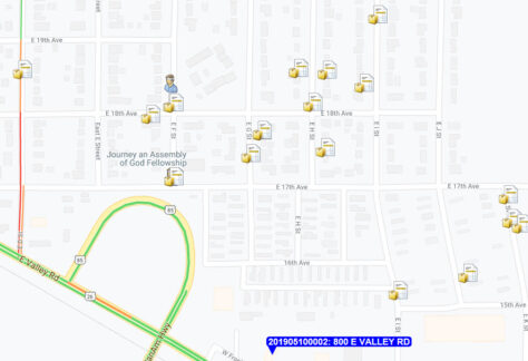
With RIMS Mapping you have a status map display that depicts your situation at all times. All active incidents are noted on the map with their type and address. Assigned units are shown color-coded based on their status at their incident locations. Units and incidents automatically blink on and off the map as the situation changes.

Mapping with E911
With the RIMS E911 link, you immediately see the location of 911 calls on the map, zoomed to the neighborhood level. This happens as soon as the dispatcher answers the phone without any action on their part. This is what we mean by the RIMS total integration approach – CAD, records management, mapping, and E911, working together as one system.
E911 Phase II and RapidSOS Integration
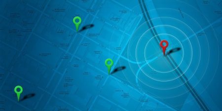
It has become increasingly important for communications centers to be able to pinpoint the location of 911 calls from cell phones. The nationwide project to make this possible is called E911 Phase II and RIMS mapping fully supports this new technology. When a 911 call from a cell phone is received, RIMS automatically zooms in the map and pinpoints the location with a circle drawn around it. The radius of the circle represents the uncertainty in the location as reported by the wireless carrier.
Offenders
22 TYPES of Offender information entered into RIMS can be displayed in RIMS Map. Offenders include Arrest Warrants, Sex Offenders, Known Offenders, Burglars, Robbers, Thieves, Arsonists, Trespassers, Parolees, Probationers, Narcotic Offenders, and more.

Automatic Vehicle Location ( AVL ) with Playback
If you have the RIMS Mobile Computer System and in-vehicle GPS devices, then you have automatic vehicle location. There is no additional cost. RIMSMap automatically displays your vehicle locations on the maps in the station, tracking vehicles as they drive around your jurisdiction. For dispatchers, this provides yet another visual of the current situation. When a unit is to be dispatched, it shows the closest unit with one glance at the map. For supervisory personnel, the visual of units on the map makes keeping track of what’s going on much easier.
You can also choose to activate AVL in the vehicle for field supervisors and even officers, providing the same vehicle tracking features are available in the station.
Perhaps the most intriguing feature of RIMS Mapping is the ability to play back “movies” of vehicle movements on the map. For example, if there is a serious incident, such as a bank robbery or pursuit, you can replay the real-time response of all units responding to the incident or participating in the pursuit. The playback can be saved to an external file for playback in court. Likewise, the GPS data can also be exported in a variety of formats.
Pin Mapping
Pin mapping – placing pins on a map to visually represent the locations of crimes – has been around for many years because it is an excellent tool for investigating and visually representing criminal activity. With RIMS Mapping the process of creating pin maps is reduced to seconds. The possibilities of the kinds of pin maps that can be created are virtually unlimited. That’s because pin mapping in RIMS is tied directly to the extremely versatile RIMS Search facility. You simply define the search parameters and run the search, view the results, and press the Map button to quickly create a pin map. It’s that easy!
It All Fits Together
RIMS Mapping is yet another example of the RIMS total integration approach – CAD, records management, mapping, E911, mobile computers, AVL – All working together as one integrated system providing personnel with real-time information, truly multiplying their impact in increasing the efficiency of your operation.
MOBILE MAPPING
RIMS Mapping is also available for use with Mobile RIMS.
Besides using the map for reference purposes, officers and supervisors can get the same incident and unit status information available to dispatchers, map directions to a call for service, and view geo-fencing information.
ADDITIONAL FEATURES
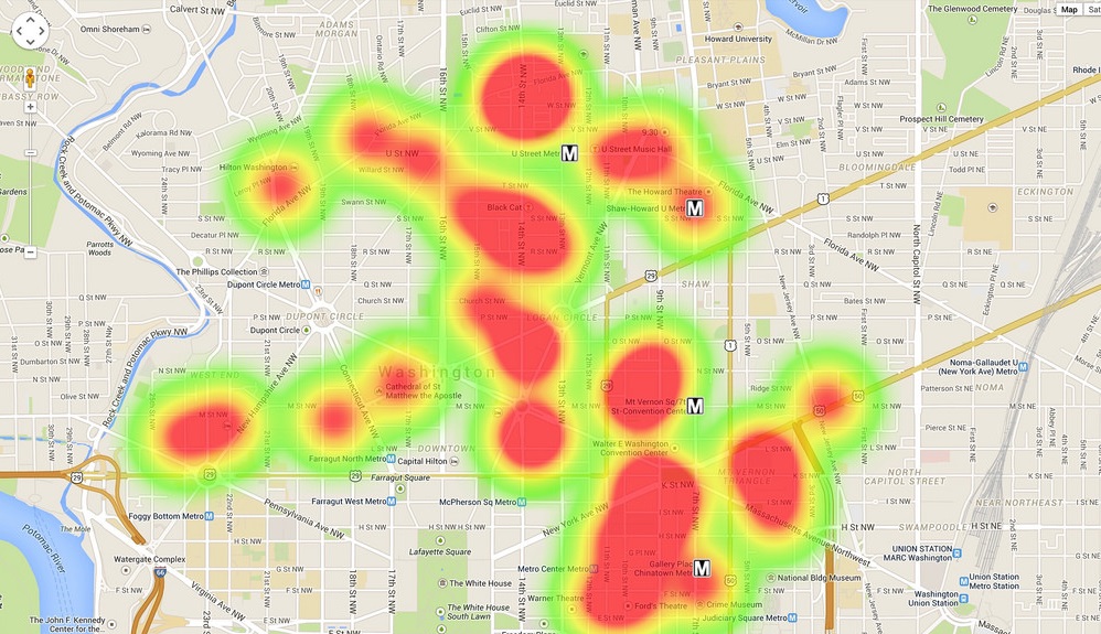
- Heat Maps
- Hot Spot Analysis Mapping
- Use Cluster Analysis Tools
- Create Charts

